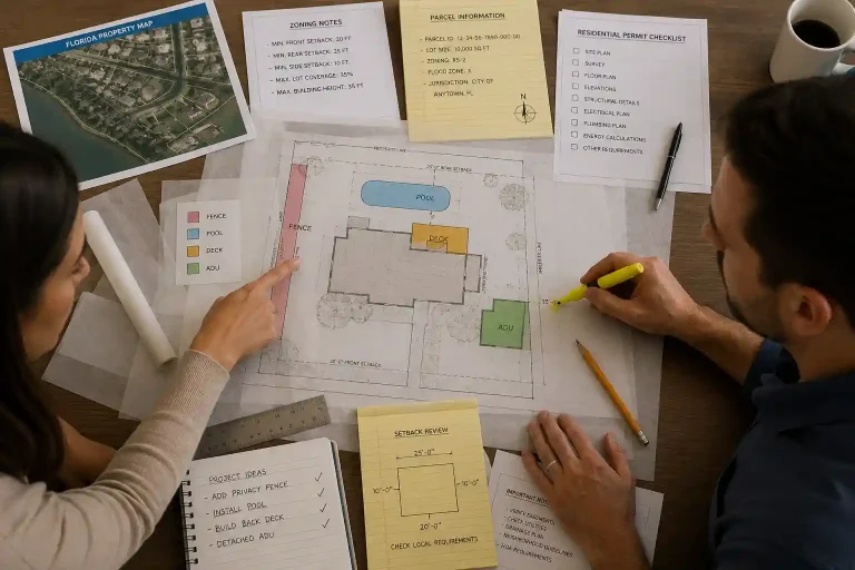
Why GIS Parcel Data Matters for Site Plan Accuracy
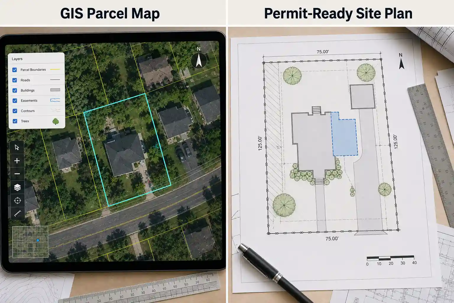
Accurate property information is the foundation of every successful site plan. Whether a project involves residential construction, additions, commercial improvements, or land development, the accuracy of property boundaries and existing conditions directly affects permit approval. A GIS site plan uses Geographic Information System (GIS) data to organize, visualize, and analyze property information, helping professionals create clearer and more reliable drawings.
Unlike traditional methods that rely only on measurements collected manually, GIS parcel data provides digital information about property boundaries, ownership records, lot dimensions, and geographic features. This data helps reduce errors during site plan preparation by creating a more accurate representation of how a property exists in the real world.
Table of Contents
- What Is a GIS Site Plan?
- How GIS Parcel Data Improves Site Plan Accuracy
- Key Features Included in a GIS Site Plan
- How GIS Site Plans Support the Permit Approval Process
- How GIS Site Plans Are Created: The Process Behind Accurate Mapping
- GIS Site Plan vs Traditional Site Plan: Understanding the Difference
- Important Limitations of GIS Parcel Data
- When Should You Use GIS Information for a Site Plan?
- Common Mistakes When Using GIS Parcel Data
- Why GIS Site Plans Are Becoming More Important
- Final Thoughts
- Accurate Parcel Data. Accurate Site Plans.
- Frequently Asked Questions
What Is a GIS Site Plan?
A GIS site plan is a property drawing created or enhanced using Geographic Information System data to display accurate information about a specific parcel. GIS technology combines mapping information with property records, allowing users to analyze land features, boundaries, structures, and development conditions in a digital environment.
Traditional site plans typically focus on showing construction details, measurements, and property layouts. A GIS-based approach adds another layer of accuracy by connecting the drawing with verified geographic information. This allows professionals to understand not only where features are located but also how they relate to surrounding land conditions.
GIS parcel data can include property lines, road locations, zoning information, elevation details, utility information, and environmental features depending on the available records. When integrated into a site plan, this information provides a stronger foundation for design decisions and permit documentation.
How GIS Parcel Data Improves Site Plan Accuracy
GIS parcel data improves site plan accuracy by providing detailed geographic information that helps professionals understand property boundaries, dimensions, and existing site conditions more clearly.
Creating More Reliable Property Boundaries
One of the most important purposes of GIS parcel data is improving the accuracy of property boundaries. Incorrect boundary information can create serious problems during construction planning because structures may accidentally be placed too close to property lines or outside the permitted area.
A GIS site plan uses digital parcel information to help identify the approximate location and shape of a property. This allows designers and contractors to better understand the available building area before planning new improvements.
While GIS data does not always replace a professional land survey when one is required, it provides valuable reference information during the early planning stages. It helps identify potential issues before investing time and money into detailed drawings.
Supporting Better Property Measurements
Accurate measurements are essential for permit approval. Building departments often review distances between structures, property lines, access points, and other improvements before approving construction projects.
GIS parcel data helps provide a clearer understanding of lot size, parcel dimensions, and spatial relationships between different property features. When combined with field measurements and project details, a GIS site plan becomes a more dependable resource for preparing permit submissions.
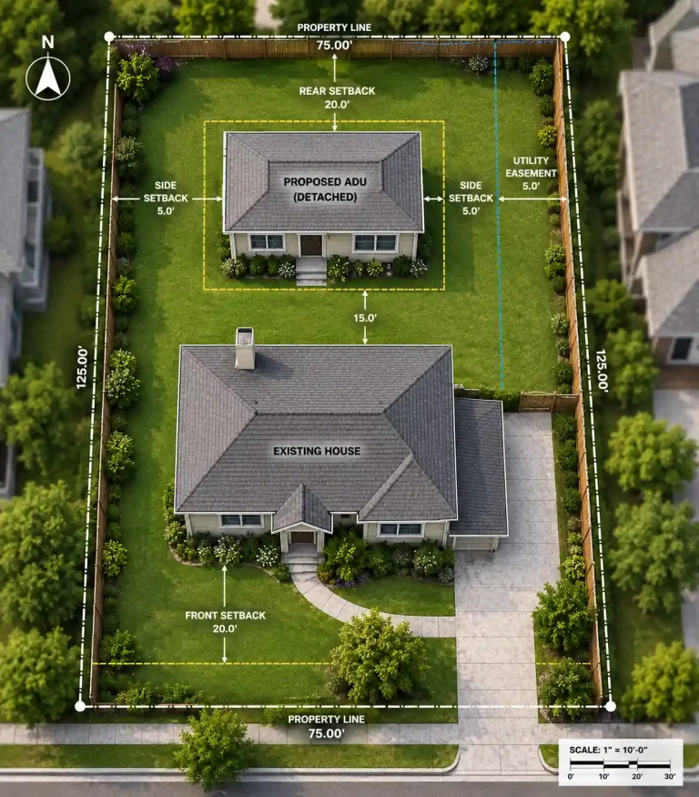
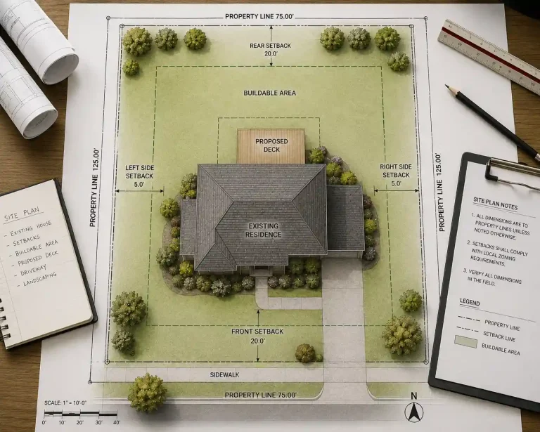
Accurate measurements are especially important when showing property setbacks on a site plan, as municipalities often review distances between structures and property lines.
Key Features Included in a GIS Site Plan
A GIS site plan combines accurate geographic information with detailed property data to create a clearer view of existing conditions and development possibilities. These plans include essential mapping elements that improve accuracy, support design decisions, and help ensure smoother permit reviews.

Each feature contributes to creating a reliable representation of the property.
Parcel Boundaries and Legal Property Information
A major component of any GIS-based site plan is accurate parcel boundary information. These boundaries define the limits of the property and provide the framework for placing existing and proposed improvements.
GIS parcel records may include parcel identification numbers, property outlines, ownership-related information, and geographic references. Including this information helps ensure that the site plan represents the correct property and supports easier review by permitting authorities.
Existing Structures and Property Improvements
A complete GIS site plan should clearly represent existing conditions whenever possible. Existing houses, garages, sheds, driveways, walkways, fences, and other permanent improvements influence how new construction can be placed on the property.
By combining GIS information with project-specific details, professionals can create a more complete picture of the current site layout. This allows reviewers to evaluate whether proposed improvements fit appropriately within the existing property conditions.
Road Access and Surrounding Features
Access is another important factor considered during site plan review. GIS mapping can help identify nearby roads, entrances, public access points, and surrounding land features that affect property development.
Understanding the relationship between a parcel and surrounding areas helps determine whether a proposed project has appropriate access and whether additional considerations may be required during permitting.
Geographic Orientation and Mapping Information
A properly prepared GIS site plan also benefits from accurate geographic orientation. Mapping details such as directional information, surrounding features, and location references help users understand the relationship between the property and its environment.
This information improves communication between property owners, designers, contractors, and government reviewers by creating a consistent visual reference.
How GIS Site Plans Support the Permit Approval Process
A GIS site plan supports permit approval by providing accurate property information, clear visual documentation, and reliable mapping data that helps officials review boundaries, structures, zoning requirements, and proposed improvements efficiently.
Helping Reviewers Understand Property Conditions
Permit reviewers need clear documentation before approving construction projects. A well-prepared site plan allows them to quickly evaluate property layout, proposed improvements, and compliance with local development requirements.
GIS information strengthens this process by providing additional geographic context. Instead of viewing a property as an isolated drawing, reviewers can better understand how it fits within the surrounding area.
Reducing Common Site Plan Errors
Many site plan problems occur because of inaccurate boundaries, missing features, or incorrect assumptions about property conditions. These mistakes can result in delayed approvals, revision requests, or additional documentation requirements.
Using GIS parcel data helps reduce these risks by improving the accuracy of the information used during site plan preparation.
How GIS Site Plans Are Created: The Process Behind Accurate Mapping
Creating a GIS site plan involves collecting parcel data, analyzing geographic information, integrating project details, and refining drawings to produce accurate maps that represent property conditions, boundaries, and proposed developments clearly.
Collecting and Reviewing Available GIS Data
Creating a reliable GIS site plan begins with collecting relevant geographic information from available sources. GIS databases may include parcel boundaries, aerial imagery, zoning information, road networks, topographic details, and other property-related records.
Professionals review this information to understand the basic characteristics of the property before developing the final site plan. This initial stage helps identify important details such as property shape, surrounding features, and possible limitations that may affect construction planning.
The quality and availability of GIS information can vary depending on the location and the municipality providing the data. For this reason, GIS information is typically reviewed carefully before being used as part of a permit submission.
Integrating GIS Data With Project Information
After reviewing available parcel information, GIS data is combined with project-specific details. These details may include proposed additions, accessory structures, driveways, decks, pools, fences, or other improvements planned for the property.
A GIS site plan becomes more valuable when digital parcel information is combined with accurate project measurements and existing site conditions. This creates a clearer representation of how the proposed construction will fit within the property.
The integration process allows designers to identify potential conflicts early, such as limited building space, setback challenges, or conflicts with existing features.
Refining the Final Site Plan for Permit Review
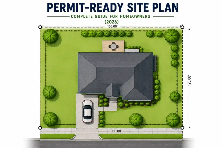
The final stage involves organizing all information into a clear and readable drawing. A permit-ready site plan should present property boundaries, structures, dimensions, access areas, and other required details in a format that building officials can easily review.
GIS data provides the geographic foundation, while professional drafting techniques ensure the final document meets local submission standards. The combination of accurate data and clear presentation creates a stronger permit package.
GIS Site Plan vs Traditional Site Plan: Understanding the Difference
A GIS site plan uses digital mapping data to improve property accuracy, while traditional site plans rely mainly on measurements and drawings. Understanding their differences helps choose the right approach for projects.
Traditional Site Plans and Their Limitations
Traditional site plans are commonly created using measurements, sketches, surveys, and construction documentation. They focus primarily on showing the relationship between property features and proposed improvements.
Although traditional methods remain useful, they can sometimes depend heavily on manual measurements and available records. If the original information is outdated or incomplete, errors may appear during the planning process.
Advantages of Using GIS-Based Information
A GIS site plan adds a digital mapping layer that improves understanding of property conditions. Instead of viewing individual measurements separately, GIS allows users to analyze property information within a larger geographic context.
This approach helps identify relationships between boundaries, structures, roads, and surrounding features. It also makes it easier to update information as property conditions change over time.
For projects where location accuracy and property context are important, GIS provides an additional level of confidence during planning and review.
Important Limitations of GIS Parcel Data
GIS parcel data provides valuable property insights, but it may not always reflect exact boundaries or current conditions. Understanding its limitations helps professionals determine when additional surveys or verification are required.
GIS Data Does Not Always Replace a Land Survey
Although GIS parcel information provides valuable accuracy, it is important to understand that it does not always replace a professional boundary survey.
GIS data is often created from public records, mapping systems, and historical information. While it is highly useful for planning purposes, small differences may exist between GIS boundaries and legally surveyed property lines.
For projects requiring exact boundary verification, construction staking, or legal property confirmation, a licensed surveyor may still be necessary. GIS data does not always replace a professional land survey when exact boundary verification is required.
Data Accuracy Depends on Available Records
The reliability of a GIS site plan depends on the quality of the available GIS information. Some municipalities maintain highly detailed databases, while others may have limited or outdated records.
Before relying on GIS information, professionals should evaluate whether the available data is suitable for the specific project requirements.
Understanding these limitations helps prevent overreliance on digital mapping information and ensures the correct documentation is prepared.
When Should You Use GIS Information for a Site Plan?
GIS information is useful for residential, commercial, and development projects where accurate property visualization is needed. It helps evaluate boundaries, existing features, and planning conditions before preparing detailed site plans.
Residential Construction Projects
GIS data can be extremely helpful for homeowners planning additions, garages, decks, pools, patios, and accessory structures. It provides an early understanding of property layout before investing in detailed design work.
Homeowners can use this information as a starting point when preparing a permit-ready site plan for homeowners that meets local approval expectations.
A GIS site plan can help homeowners visualize available space, identify possible restrictions, and prepare more organized permit documents.
Commercial and Development Projects
For larger projects, GIS information can support early planning by showing surrounding land conditions, access points, and property relationships.
Developers and contractors can use GIS-based information to evaluate site opportunities and identify potential challenges before beginning detailed engineering or construction planning.
For larger developments, a detailed commercial site plan guide can help explain the additional requirements involved in preparing accurate permit documentation.
Property Research and Planning
GIS information is also valuable for property owners who want to understand their land before making improvement decisions. It allows them to review boundaries, nearby features, and development possibilities from a digital perspective.
Common Mistakes When Using GIS Parcel Data
Using GIS parcel data incorrectly can lead to inaccurate assumptions about boundaries, outdated information, or incomplete documentation. Understanding common mistakes helps ensure a reliable GIS site plan for planning and permit approval.
Treating GIS Boundaries as Exact Survey Lines
One common mistake is assuming that GIS parcel boundaries are always legally exact. While GIS provides useful reference information, property lines may require professional verification depending on project requirements.
Using GIS information correctly means understanding its purpose and limitations.
Using Outdated Property Information
Another issue occurs when outdated GIS records are used without checking for recent property changes. Subdivisions, additions, new structures, or boundary adjustments may not always appear immediately in available databases.
Reviewing current information helps create a more accurate GIS site plan and reduces unexpected issues during permitting.
Ignoring Local Permit Requirements
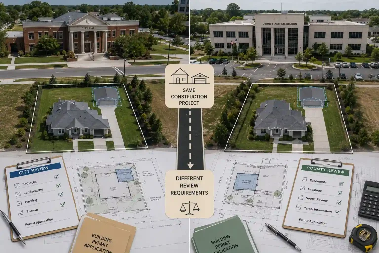
Different municipalities have different expectations for site plan submissions. Some may accept GIS-based information for certain projects, while others may require additional documentation.
Understanding local requirements ensures the final site plan includes everything necessary for approval. Many approval delays happen because of common site plan rejection reasons, such as missing details, inaccurate measurements, or incomplete documentation.
Why GIS Site Plans Are Becoming More Important
As property development becomes more complex, accurate digital information plays a greater role in planning and permitting. GIS technology allows professionals to analyze property conditions more efficiently and create clearer documentation.
A GIS site plan combines geographic information with traditional site planning methods to improve accuracy, reduce confusion, and support better decision-making throughout the construction process.
For homeowners, contractors, and designers, GIS data provides a valuable starting point for understanding property conditions before moving forward with development plans.
Final Thoughts
GIS parcel data has changed the way property information is collected, analyzed, and presented. By combining digital mapping technology with accurate project details, a GIS site plan provides a clearer understanding of boundaries, existing conditions, and proposed improvements.
While GIS information is not always a replacement for professional surveying, it remains an important resource for improving site plan accuracy and reducing planning mistakes. When used correctly, GIS data helps create more reliable permit documents and supports smoother project approvals. Contact our team today or explore our site plan services for GIS site plan services.
Accurate Parcel Data. Accurate Site Plans.
We pull official GIS parcel and zoning data for your address — no guesswork, no outdated maps. Get a professional, permit-ready site plan starting at $129, delivered in 24–48 hours and accepted by building departments in all 50 states.
✅ 98% first-time approval rate | ✅ Unlimited free revisions | ✅ Money-back guarantee
Get an Accurate Site Plan →Frequently Asked Questions
What is a GIS site plan?
A GIS site plan is a property drawing that uses Geographic Information System data to display parcel boundaries, property features, and location-based information. It helps improve accuracy during planning and permit preparation.
Does GIS parcel data replace a property survey?
No, GIS parcel data does not always replace a professional survey. GIS information is useful for planning and reference, but surveys may be required for exact legal boundaries and construction verification.
What information can be included in a GIS site plan?
A GIS site plan may include property boundaries, parcel information, roads, structures, aerial imagery, zoning details, geographic features, and other location-based information depending on available data.
Why is GIS data useful for permit applications?
GIS data helps create more accurate site plans by providing additional information about property layout, boundaries, and surrounding conditions. This can reduce errors and improve permit documentation.
Can homeowners use GIS data for planning projects?
Yes, homeowners can use GIS information to better understand their property before planning additions, garages, decks, pools, or other improvements. It provides a useful starting point before creating detailed permit drawings.